The wonderful and versatile state was founded by the local Chieftain Kempe Gowda in 16th sanctuary. In 1956, the Kannada-speaking region was formed in groups along with the princely state of Mysore to form with name of Karnataka in 1973. Karnataka, the "Lofty land" is bordered by Andhra Pradesh, Maharashtra in North and Tamilnadu and Kerala in the South. A very long coastline hedged by miles and miles of tall, waving, palm groves frames this pretty land. The majority of the Karnataka state lies on the Deccan Plateau. Bangalore is the state capital. India's Manhattan and Silicon Valley. The state boasts a varied flora and fauna, truly a nature tourist's paradise. The state's long and colourful history, and the many palaces, historical building, forts, temples, mosques, and churches are example of great versatility of different culture and traditions. The state is enriched with a rich cultural heritage. The folk culture has an ancient and rich tradition, the two principal forms being Yakshagana and the puppet shows. Karnataka has great array of the tourists places, the capital city Bangalore is known as a Garden city Jog Falls, the beaches of Karwar and Malpe, stone ancient temples of Halebid and Belur Golgumbuz in Bijapur, Mysore Palace, the list is endless. The state is paradise of shopping world famous Sandalwood, silk and rosewood. Rosewood and Silk and handicrafts.
Bangalore the capital of Karnataka is known as the Manhattan and silicon city, there are many things that are considered to be 'taboo' and off-limits in India have become acceptable in this city, offering a refreshing and more relaxed atmosphere than other cities of other region of India. The city was founded during early of 16th century; Bangalore is often referred to as the country 'Garden City', due to its various wonderful parks and green spaces. The Bangalore Fort was built by Kempe Gowda and expanded by Emperor Tippu Sultan. In side the vicinity of the fort there is the Ganapati temple built in 16th century. The Bangalore Palace was built by a Wodeyar king in 1887 on the huge 400 acre space. This palace was built in the Tudor style, complete with foiled and Gothic windows, battlements and turrets akin to the Daria Daulat Palace in Srirangapatnam; the regal summer palace has been built largely of wood and is famous for its carving and paintings. In year 2005 Srikantadatta Narasimharaja Wodeyar took decision to open the palace to the public to meet around Rs 20 Lacs annual upkeep cost of the palace. The major attraction is a gallery of nearly a 1000 historical photos, including those of kings, viceroys, maharajas and other famous icons and personalities. For tourists visiting Bangalore, there are lots of amazing sightseeing places to explore, historical buildings, palaces, gardens, parks, monuments, ancient temples many more.
Altitude: 920 meters, Temperature: (deg C) Summer- Max. 35, Min. 20. Winter- Max. 28, Min. 14., Rainfall: 86 cms.(June to October), Best Season: (Sep. to March is the best time).
Aquarium, Bull Temple, Fort & Tippu's Palace, Ulsoor Lake, Lal Bagh, Venkatappa Art Gallery, Cubbon Park, Vidhana Soudha, Vishveswaraya Industrial & Technological Museum.
Halebid- 16 kms, Sravanabelagola- 86 kms, Gorur- 61 kms.
By Air: Linked with Calcutta, Delhi, Madras, Bombay, Pune, Ahmedabad, Coimbatore, Goa, Hyderabad, Calicut and Trivandrum.
By Rail:Directly connected with Ahmedabad, Bombay, Calcutta, Cochin, Delhi, Guwahati, Howrah, Hyderabad, Mangalore, Madras, Mysore, Nagpur, Trivandrum, Vasco-da-Gama (Goa).
By Road: Bandipur- 220 kms, Belur- 322 kms, Madras- 334 kms, Bombay- 9100 kms, Cochin- 526 kms, Dandeli- 481 kms, Halebid- 214 kms, Jog Falls- 377 kms, Kodaikanal- 430 kms, Mysore- 140 kms, Panaji- 595 kms, Sravanabelagola- 160 kms, Tirupati- 250 kms.
Bangalore the capital of Karnataka is known as the Manhattan and silicon city, there are many things that are considered to be 'taboo' and off-limits in India have become acceptable in this city, offering a refreshing and more relaxed atmosphere than other cities of other region of India. The city was founded during early of 16th century; Bangalore is often referred to as the country 'Garden City', due to its various wonderful parks and green spaces. The Bangalore Fort was built by Kempe Gowda and expanded by Emperor Tippu Sultan. In side the vicinity of the fort there is the Ganapati temple built in 16th century. The Bangalore Palace was built by a Wodeyar king in 1887 on the huge 400 acre space. This palace was built in the Tudor style, complete with foiled and Gothic windows, battlements and turrets akin to the Daria Daulat Palace in Srirangapatnam; the regal summer palace has been built largely of wood and is famous for its carving and paintings. In year 2005 Srikantadatta Narasimharaja Wodeyar took decision to open the palace to the public to meet around Rs 20 Lacs annual upkeep cost of the palace. The major attraction is a gallery of nearly a 1000 historical photos, including those of kings, viceroys, maharajas and other famous icons and personalities. For tourists visiting Bangalore, there are lots of amazing sightseeing places to explore, historical buildings, palaces, gardens, parks, monuments, ancient temples many more.
Altitude: 968 meters, Temperature: (deg C) Summer- Max. 34, Min. 20. Winter- Max. 28, Min. 14., Rainfall: 86 cms. (June to October), Best Season: Throughout the year.
Chenakesava Temple, Veernarayan Temple, Kappe Chennigaraya Temple.
Halebid- 16 kms, Sravanabelagola- 86 kms, Gorur- 61 kms.
By Air: The nearest airport Mangalore- 154 kms is connected to Bangalore, Bombay and Madras.
By Rail: Nearest railhead Hassan- 37 kms is connected to Mangalore.
By Road: Bangalore- 222 kms, Halebid- 16 km, Hassan- 37 kms, Mangalore- 154 kms, Mysore- 155 kms, Shravanabelagola- 86 kms, Belur- 91 kms, Halebid- 117 kms.
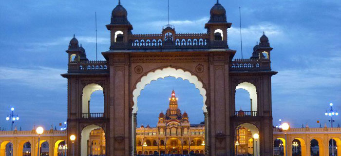
Mysore lists 140 kms from Bangalore, the abode of splendour and glorious past. Mysore is the second largest and most vibrant city of Karnataka. The old capital city of the Wodeyars has always enchanted its admirers with its old-world charm, majestic heritage. It is worldly known for its exotic sandalwood and rich silks. The city has charming places: grand ancient palaces, picturesque gardens waterfalls, museums and modern amusement parks, historical regal buildings, broad shady avenues and sacred temples. There's a heritage old world appeal about the city that come out and leaves no one untouched. The city of Mysore is known as the 'City Of Palaces'. There are various palaces and buildings built by the Royal family and are exquisite examples of Dravidian architecture and recall grandeur and lavish life lead by the Emperors, who ruled this city. There are number of other tourist's attractions in the city.
In the past was called Mahishur, traces its history back to the mythical past, when wicked buffalo headed demon Mahishasura was killed by Goddess Chamundeshwari Devi of Chamundi hills. Now the city is known as Mysore. One of the popular spots is the Chamundi hills and the temple on top of the hills. Mysore Dashara festival is quite popular among the tourists and locals, a grand celebration of victory of good over evil. Mysore is also placed and played a prominent existence in great history of Mahabharata and King Ashoka of the 3rd century B.C. During the Wodeyar rule Mysore achieved pinnacle of its glory as a legendary centre of oriental splendour.
Today it has developed into a modern and developed city like many other cities in the country. Without loosing touch with its rich historical and cultural legacy. Situated 770m above sea level, Mysore has a warm and cool climate throughout the year.
Somnathpur- 40 kms, Sravanabelgola- 99 kms, Belur- 91 kms, Halebid- 117 kms.
By Air: The nearest Airport is Bangalore.
By Road: 140 kms from Bangalore.
Badami, the one time capital of the Chalukyas, is noted for several temples, some structural and others rock-cut, of the sixth-seventh century A.D.
Area: 10.3 sq.km., Altitude: 176.7 mts., Temperature: (deg C) Summer- Max. 38, Min. 23. Winter- Max. 29, Min. 15., Rainfall: 50 cms., Best Season: October to March.
Badami Caves, Badami Fort, Sculpture Gallery.
Aihole- 44 kms, Banashankari Temple- 50 kms, Guledgud- 24 kms, Lakkundi- 82 kms, Mahakuta- 14 kms, Naganath Temple- 10 kms, Pattadakal- 22 kms, Kada Siddeswara Temple, Jambulinga Temple, Galaganatha Temple, Sanghameswara Temple, Mallikarjuna Temple, Virupaksha Temple, Papanatha Temple, Jain Temple, Shivayoga, Mandira- 11 kms, Pattadakal.
By Air: The nearest airport Belgaum- 192 kms is connected to Bombay.
By Rail: Nearest railhead Badami.
By Road: Connected to important places in the south.
It is historically famous as the cradle of the Hindu temple architecture. There are almost 125 temples divided into 22 groups scattered all over the village.
Area: 4 sq. km., Altitude: 593 meters., Temperature: (deg C) Summer Mean Max. 41 deg. Mean Min 28 deg. Winter Mean Max 31 deg. Mean Min 20 deg., Rainfall:58.4 cms., Best Season: October to March.
Durga Temple, Ladh Khan Temple, Gowda Temple, Suryanarayan Temple Konti Group of Temples, Hucchimalli Temple, Meguti Temple, Ravanphadi Cave.
Badami- 44 kms, Koodalasangama- 45 kms, Pattadakal- 22 kms.
By Air: The nearest airport is Belgaum - 189 kms.
By Rail: The nearest railhead is Bagalkot- 34 kms.
By Road: Badami- 44 kms, Aminagad- 10 kms, Bagalkot- 34 kms, Bangalore- 510 kms, Bijapur- 135 kms, Pattadakal- 22 kms.
Hampi was once the glorious capital of mighty Vijayanagar Empire (1336-1565), from the Deccan Plateau to the tip of the Peninsula. Founded in the middle of the 14th century by two local princes, Hukka & Bukka, the Vijayanagara empire came to be celebrated for its might and wealth and as a showpiece of imperial magnificence. The emperors of this dynasty were great patrons of art and architecture which can still be seen in the vast ruins of Hampi. In an effort to resurrect this abandoned capital, the government has been involved in the restoration, excavation and protection of the ruins which spread over an area of 26 sq. kms. The terrain is dominated by rocky hills and the mighty Tungabhadra river which flows through this rugged landscape.
Temperature: (deg C) Summer- Max. 41, Min. 37. Winter- Max. 27, Min. 24., Best Season: October to March.
Virupaksha Temple, Monolithic Ganeshas, Krishna Temple, Monolithic Narsimha, Hazara Rama Temple, Elephant Stables, Zenana Enclosures, Royal Performance Zone, Royal Residences, Quieen's Bath, Vittala Temple, Achyuta Raya Temple, Kodandarama Temple.
Tungabhadra Dam-17 kms.
By Air: The nearest airport is Bellary- 77 kms, Belgaum- 259 kms, Bangalore- 353 kms.
By Rail: The nearest railhead is Hospet- 13 kms which is connected to Bangalore, Hubli and Guntakal.
By Road: Connected to Aihole- 156 kms, Badami- 189 kms, Bangalore- 353 kms, Bellary- 77 kms, Bidar- 379 kms, Bijapur- 254 kms, Hungund Gadag- 91 kms, Gulbarga- 264 kms, Guntakal- 133 kms, Hassan- 335 kms, Hospet- 13 kms, Hubli- 154 kms, Hyderabad- 416 kms, Mysore- 366 kms, Raichur- 194 kms.
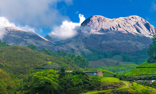
The name Nagarhole is derived from the Kannada `Naga' meaning `snake' and `Hole' meaning `streams'. A number of streams snake through the rich tropical forests of Nagarhole which is situated in picturesque districts of Kodagu and Mysore in Southern Karnataka.
Area: 572.90 sq.km. Altitude: 800-850 meters, Temperature: (deg C) Max. 33 Deg.C. Min. 14 Deg.C., Rainfall: 1300 - 1800 mm. (June to September), Best Season: September to May.
Southern tropical semi-evergreen forests. Southern tropical dry deciduous forests. Southern tropical moist mixed deciduous forests. Scrub forests. Lush, green, grassy swamps.
Lots of animals and birds.
Bandipur National Park- 100 kms, Madikeri- 93 kms, Mysore- 96 kms.
By Air: The nearest airport is Mysore- 96 kms, Bangalore- 236 kms.
By Rail: The nearest railway station is Mysore- 96 kms.
By Road: Bangalore- 236 kms, Madikeri- 93 kms, Mysore- 96 kms.
The Moyer River forms a natural boundary between the Mudumalain Wildlife Sanctuary in Tamilnadu and the Bandipur National Park in Karnataka. Nestling at the foothills of the Nilgiris, the Bandipur National Park was formed by extending the Venugopal Wildlife Park which was set up in 1931 by the Mysore Maharajas. A popular game resort of the rulers of Mysore, the flora in the forest comprises of teak, rosewood, honne, mathi, bamboo, sandal trees. The important animals in the park are the tiger, elephant, gaur, leopard, chital, samber, etc. Birds like the pea fowl, partrige, quail, hornbill, Ibis, etc., are also found here. The Bandipur National Park is one of the fifteen Tiger Reserves in the country, launched under the Project Tiger scheme during 1973.
Area: 874 sq.kms., Altitude: 780 to 1454.5 meters, Temperature: (deg C)-Maximum 29 Deg. Minimum 17 Deg., Rainfall: 1000 mm., Best Season: May to June & September to November.
Southern Tropical Moist-mixed deciduous forests, Southern Tropical Dry Deciduous Forests, Scrub Forests. Flora Forests consists predominantly of teak (tectona grandis) with its main associate species like rosewood.
Lots of wild animals tiger, elephant, deer, wild boar etc.,
Mudumalai Wildlife Sanctuary- 19 kms, Mysore- 80 kms, Udhagamandalam (Ootacamund)- 79 kms, Gopalaswamy Hills- 20 kms.
By Air: Nearest airport is Mysore- 80 kms.
By Rail: Nearest railhead is Mysore- 80 kms.
By Road: Bangalore- 220 kms, Coimbatore - 168 kms, Mysore- 80 kms. Udhagmandalam ( Ooty)- 79 kms.
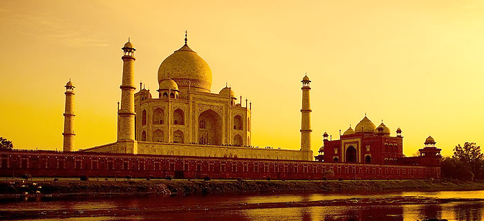
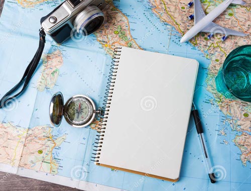
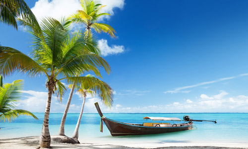
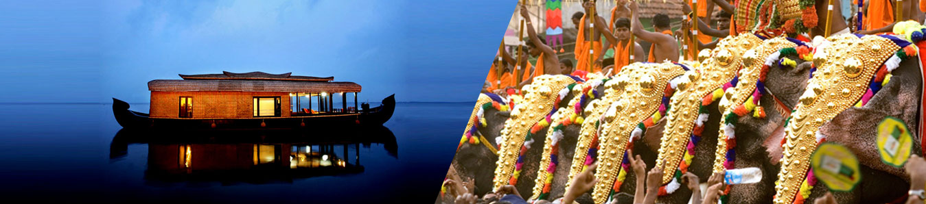
Explore South India, with most fascinating state Karnataka, Karnataka travel agency offers South India Karnataka tours, travel plan and tour itineraries of Karnataka, Tamilnadu, Kerala and other states of South India. Experience Karnataka hill stations, heritage monuments, forts, historical places, temples and other wonderful tourist attractions of main city of Karnataka: Bangalore, Mysore, Ooty and other tourist towns and cities. The suggested tour plans and tour itineraries can be modified as per your preferences and requirement, like nos of days in hands, travel period, preference of the hotels, specific destinations to be covered and special interest tours. Please visit to our various tour itineraries at our website link: http://www.india-tourism.net/itineraries.htm or mail us your feedback to us; we shall design a perfect customized tour of your choice. Mail us your queries at: sales@india-tourism.net
Design your tour with our expertise Plan My Trip